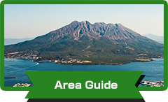
Area Guide
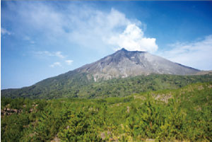
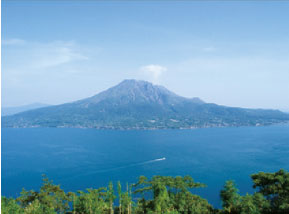
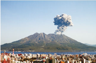
Sakurajima
-
-
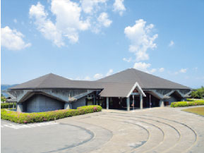
Sakurajima Visitor Center
This facility plays a central role in introducing the Sakurajima-Kinkowan Geopark. Along with videos which introduce Sakurajima and Kinko Bay, there are also exhibits showing the volcano’s eruption history (lava spectrum and stratification), volcanic products (lava, ash deposits, and ash), vegetation succession over the lava, and sea creatures. There is also a project exhibition corner where exhibits planned around Sakurajima, volcanos, and more are held. An exhibition introducing geoparks in each region of Japan will also be held.
- Information
-
-
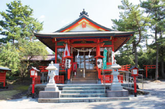
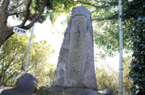
Tsukiyomi Shrine
Tsukiyomi Shrine was buried under lava following the Taisho Eruption, but was rebuilt in its current location in 1940. The go-shintai (repository for the spirits for the gods) of the shrines on Sakurajima are all enshrined pointed toward the summit of the volcano. From this you can see the residents’ sense of awe with and veneration of the volcano as a god as they coexist with it. A stone tablet inscribed with the poetry of Kyoshi Takahama can also be found nearby.
- Information
-
-
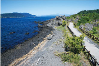
Yogan Nagisa Trail
This 3km-long trail allows you to see the Taisho lava and the vegetation growing over it. It is also a good location to view the ocean, and has many creatures living in the rocky tidal flats. There is groundwater discharged from the seafloor in areas along the coast, making some areas brackish-water regions. This environment also provides a home to an endangered species of fiddler crab.
- Information
-
- 1 km from Sakurajima Port (10 min. on foot)
- Fee: Free
- Hours: Always
- Parking: 20 vehicles
-
-
Karasujima Observatory
This observatory was built atop the former island of Karasujima, which was buried in lava following the Taisho Eruption. The surroundings are entirely the Taisho lava, with Japanese black pine groves growing nearby. Kagoshima University’s experimental forest is also found nearby; it allows a glimpse at the process of forest restoration on lava plateaus previously thought to be sterile in the ultra-long-term.
- Information
-
-
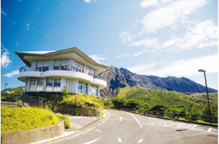
Yunohira Observatory
The observatory located nearest the summit of Sakurajima, the surface of the mountain is clearly visible. The difference in levels of valley-like abrasions on the north and south peaks make them visually distinct from one another.
One can infer the lifestyles of the people of Jomon, who lived alongside the volcano, and the disasters they faced through the archaeological sites, as well as view the volcano’s alluvial fan shape created by eroded sediment deposits.
From caldera eruptions to the Taisho Eruption to vegetation succession, the history of the end of the Edo Period, agriculture, and the daily lives of those living nearby, the scenery in this area has many stories to tell.
- Information
-
-
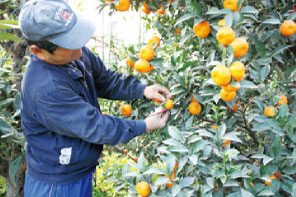
Sakurajima Ko-mikan Field
In the northwestern alluvial fan area of Sakurajima, the water drainage and sunlight are both good (due to the surface incline and light reflected off of Kinko Bay), allowing delicious citrus fruits to be produced.
Sakurajima ko-mikan (miniature mandarin oranges) are a beloved product of the alluvial fan area which was shaped by mudslides. There are trees older than 100 years, as well as trees which have produced as many as 24,649 ko-mikan at once. During the Edo Period, their quality was prized so highly that they were offered as tributes to the Shogun.
- Information
-
- The harvest period is between December and January
-
-
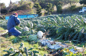
Sakurajima Daikon Radish Field
This is a field of Sakurajima daikon radishes, which have been recorded in the Guinness Book as the world’s largest. The record-holding daikon radish was 31.1 kg (approx. 68.6 lb) with a circumference of 119 cm (approx. 46.8 in).
The soil of the fields is unique for being barren land mixed with pumice. This makes it easy to fertilize the earth and, combined with good water drainage, it is simple to control nutrients and moisture creating a good environment for raising daikon radishes.
- Information
-
- The harvest period is between January and February
-
-
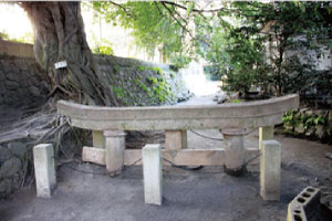
Kurokami Buried Shrine Gate
This gate serves as a monument to the disaster at the time of the dangerous Taisho Eruption. The accumulation of fallen pumice buried the gate 2 meters in just one day. Following the eruption, local residents attempted to unearth the gate, but the Mayor of their village stopped them, saying that it should be left as is as a reminder of the disaster for future generations. This precious reminder of the time of the eruption is still preserved in its buried condition.
- Information
-
-
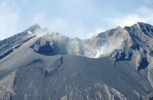
Kurokami View Spot
This view spot provides the best location to view the Showa Crater, which is still actively erupting. It is above the Showa Lava, allowing views of the lava banks and other volcanic landscapes, erosion control facilities, and vegetation succession.
Stories of how settlements of people here dismantled their homes and rebuilt them in new locations at the time of the Showa lava flow are still told.
- Information
-
- 20 km from Sakurajima Port (30 min. by car), No parking
-
-
Sakurajima-guchi
This spot connects Sakurajima to the Osumi Peninsula of mainland Kagoshima. There are completely different types of growth on either end of this area, with a grove of Japanese black pine trees on the Sakurajima side, and a secondary forest of machilus trees on the Osumi Peninsula side. This can be understood as a difference in the nature of the soil in these areas.
The hamlet of Seto, which was buried under the Taisho lava, is where Japan’s first Western-style warship the Shouheimaru was built at the end of the Edo Period.
- Information
-
- 14 km from Sakurajima Port (20 min. by car)
-
-
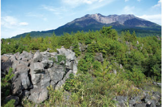
Arimura Lava Observatory
This observatory allows you to view lave from both the Taisho and Showa eruptions. The 30 year gap between the eruptions is distinguishable from the gap in the progress of the surrounding vegetation. Here you can view andesite block lava, rhyolite lava dome, Shirasu tableland created from pyroclastic flow, and more volcanic landforms up close.
- Information
-
-
Higashi-Sakurajima Elementary School/Sakurajima Eruption Memorial
The warning signs of the Taisho Eruption, the state of the following disaster, and how to prepare for such an event are all carved into this stone memorial.
“Do not trust theories, it is most vital to prepare to take shelter after witnessing an unusual event,” the monument says in a judgment of the local meteorological station and stressing preparation. It is also called the anti-science monument.
- Information
-
- 6 km from Sakurajima Port (10 min. by car), No parking
Kinko Bay
-
-
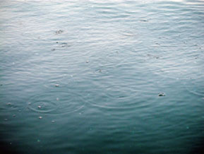
Tagiri (Volcanic hydrothermal activity)
This is a unique area where volcanic gas from the Wakamiko Caldera bubbles to the surface of the water. Local fishers call this “tagiri” which means “boiling.”
Tagiri allows you to experience firsthand the existence of this underwater volcano. The floor of this acidic body of water is a rare environment throughout the world, not only containing the habitat of the Lamellibrachia satsuma, a type of tubeworm (the shallowest depths for it in the world), but also volcanic hydrothermal vents, and rare metals (antimony, etc.).
-
-
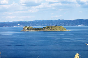
Shinjima
At the time of the Annei Eruption in the Edo Period, there was an eruption from the sea floor as well. The magma from this eruption raised the seafloor, creating the new island of Shinjima. Rifts created when the island rose from the seafloor are still largely visible.
The Shinjima pumice found on the island is a product of underwater pyroclastic flow which is estimated to date back at least 16,000 years to the activity of the Wakamiko Caldera. You can also see and actually touch the shellfish fossil deposits found here as well.
-
-
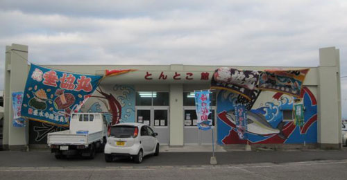
Tontoko net fishing
A type of net fishing that involves dragging the net along the bottom of the ocean to catch varieties of shrimp living in the deep sea, such as “Namikudahige-ebi” and “Himeama-ebi.” Namikudahige-ebi are a valuable variety of shrimp, being tender and sweet but only able to be eaten in this region due to spoiling easily.
The deepest part of the Kinko Bay serves as the main fishing area. This traditional type of fishery consists of extending a long rope of around 2000 meters behind the boat and dropping a net to the bottom of the ocean; skillful rope-handling is then needed to wind up the net to capture the shrimp.
-
-
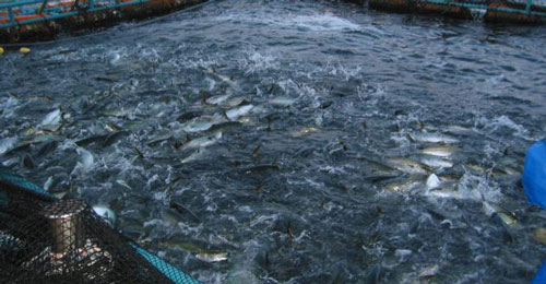
Amberjack cultivation
Cultivation of greater amberjacks and Japanese amberjacks thrives in Kinko Bay, taking advantage of the unique tranquility of the inlet with a maximum depth of over 200 meters.
The greater amberjacks cultivated in Kinko Bay, the area in Japan with the largest production of cultivated greater amberjacks, are well-received across Japan for their taste and quality, and are popular as a delicacy in the Kanto Region.
Kagoshima City
-
-
Terayama Park
From this park you can see the inner part of Aira Caldera and Kinko Bay, as well as Sakurajima. Inner Kinko Bay is a feature of the caldera which was created by Shirasu tableland following a large-scale eruption over 30,000 years ago.
Looking out from above, the Wakamiko Caldera is also found at the bottom of inner Kinko Bay, at a depth of over 200 meters. The north peak of Sakurajima is visible from this area, but the south peak is not quite so. This angle causes the volcano to appear in a shape more similar to that of Mt. Fuji. The alluvial fan at the foot of the volcano is also visible along Sakurajima’s northwestern slope.
- Information
-
- 35 min. from Kagoshima Chuo Station by car
- Parking: 10 vehicles
-
-
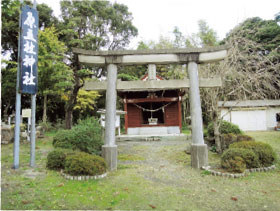
Haragosha Shrine
This shrine was built in the new village of the people of the Kurokami Area after they resettled following a large eruption in the Edo Period (the Annei Eruption). The god from the shrine of their old home is enshrined here. The Haragosha Shrine currently in the Kurokami Area uses a different Chinese character for “Hara” but that change is said to have been made following the Meiji Period.
- Information
-
- 30 min. from Kagoshima Chuo Station by car (no parking lot)
-
-
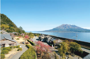
Sengan-en
The remains of the villa of Lord Shimadzu, the leader of the Satsuma Domain (former Kagoshima Prefecture), in the Edo Period the Shuseikan Project (Asia’s first group of Western-style factories) was carried out here.
Utilizing the concept of “borrowed scenery,” the garden incorporates Sakurajima which resembles a miniature hill, and Kinko Bay which resembles a lake to lend to its expansive and uniquely magnificent scenery. In 1958, Sengan-en was nationally designated as a place of scenic beauty. “Sangoku Meishozue” (The Geography of Southern Kyushu) which was written the Edo Period and showcases much of Sakurajima’s scenic beauty also features Sengan-en as one of the 8 beautiful sceneries of Kagoshima.
- Information
-
-
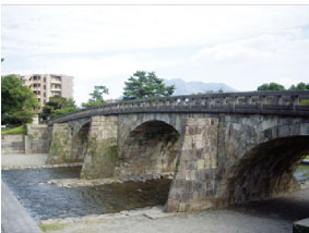
Ishibashi Memorial Park
The volcanic rock seen throughout Kagoshima City is pyroclastic flow deposit produced from a caldera eruption which occurred in the Kagoshima rift valley. As it is relatively soft, this type of rock is easily processed into building stone and its use spurred the growth of Kagoshima’s rock culture.
A memorial park for the “Five Stone Bridges of Kotsuki River” built by Iwanaga Sangoro at the end of the Edo Period, only 3 of which remained after flooding. Those three (Nishida-bashi, Korei-bashi, and Tamae-bashi) were relocated and rebuilt. The Ishibashi Memorial Museum, located in the park, is a symbol of rock culture, introducing the five bridges’ history, how they were built, and more.
- Information
-
-
Shiroyama
Shirasu, a non-welded pyroclastic flow deposit, is a product of the Aira Caldera’s eruption and forms Kagoshima’s unique Shirasu tablelands. These tablelands have been used since old times in fields, farms, castles, etc.
Kagoshima’s distinctive castle, Kagoshima Castle utilized the Shirasu tableland to achieve its form. Shiroyama is what remains of the mountainside castle where the Satsuma Domain Lord Shimadzu resided.
- Information
-
-
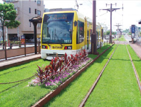
Green Railways
The grass spanning alongside the city tram railways (8.9 km in length, with 30,000 m2 of grass used) combats the effects of heat island syndrome while giving the city a refreshed atmosphere. Utilizing a ground-breaking technique that allows Shirasu to be turned into concrete blocks, the “Shirasu greening bases” were created to retain water well, disperse heat, and be pressure-resistant. The Green Railways are beloved by the citizens for reducing the surface heat of the roads, and adding to the scenery of the city.
- Information
-
- Found along railways from Kagoshima Station to the Namida-bashi tram stop area
Aira City
-
-
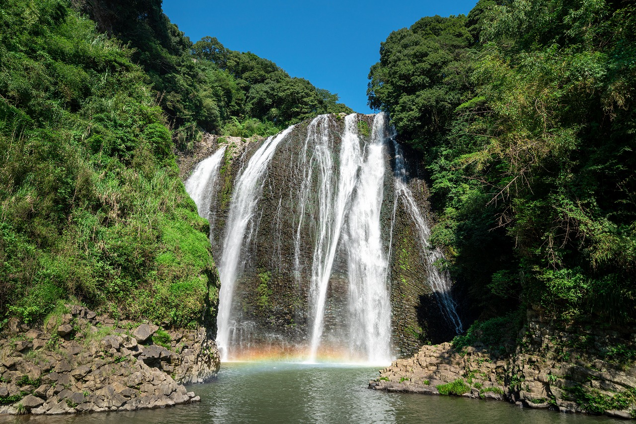
Ryumon Falls
A majestic waterfall with a height of 46 meters and a width of 43 meters, chosen as one of the 100 Best Waterfalls in Japan. The bedrock beneath the waterfall is also worth seeing. You can view the beautiful columnar joints formed in andesite(rock), which are result of cooled and solidified magma that penetrated the layers of the Kokubu Group.
- Information
-
- 35 min. from Kagoshima Chuo Station by car
- Parking: 10 vehicles
-
-
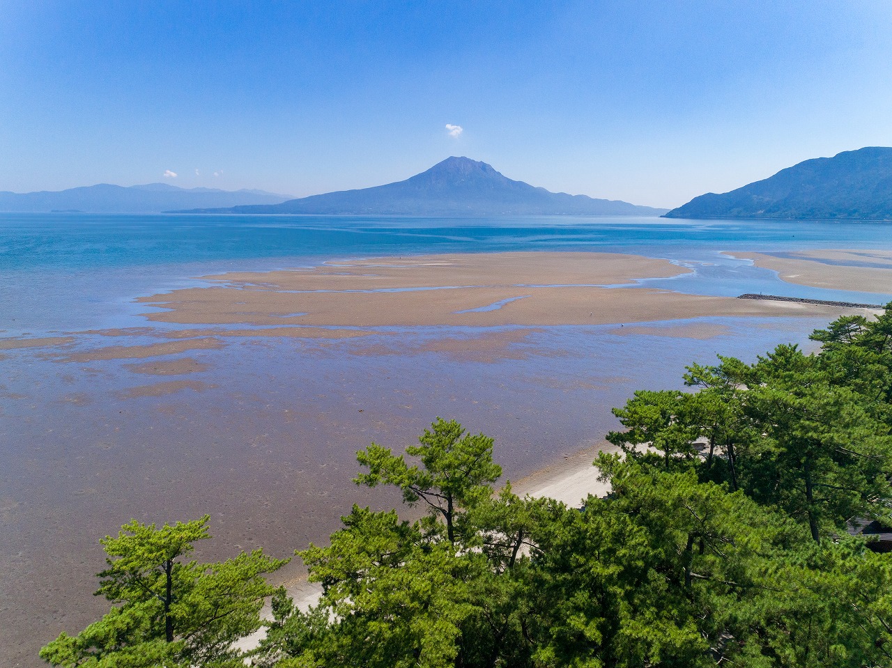
Shigetomi Coast Tideland
Approximately 300 organisms reside in this large tideland in Kinko Bay, playing a large role in purifying the ocean water and supporting biodiversity. The tideland provides a 180-degree view of Sakurajima and the Aira Caldera from the shore, and you can also enjoy a far-off view of the Kirishima Mountains.
- Information
-
- 35 min. from Kagoshima Chuo Station by car
- 10 min. from Aira IC by car
- Parking: 100 vehicles
-
-
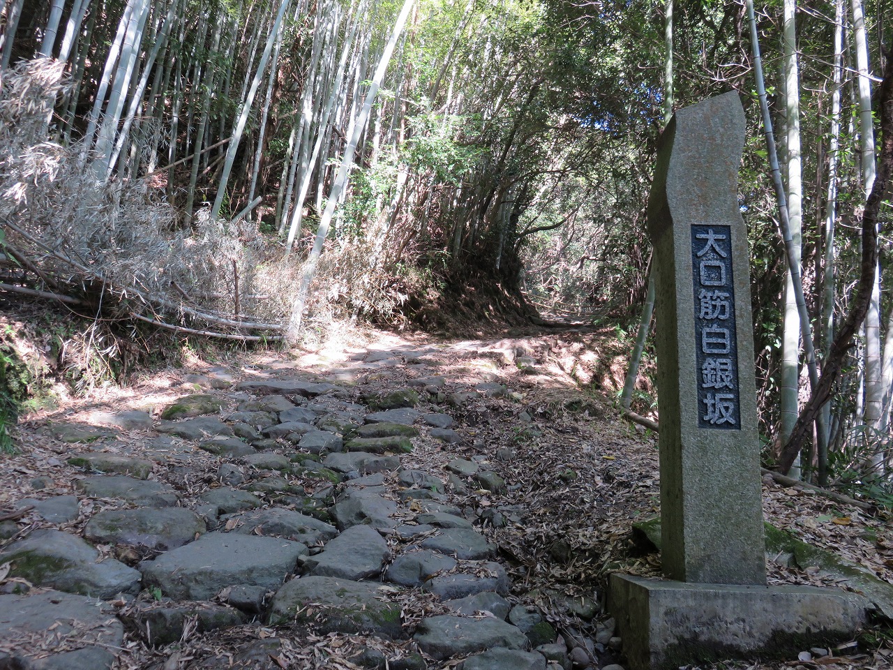
Shirakane-zaka
Part of the Oguchisuji, the main road of the Satsuma Domain. This slope has a 300-meter difference in elevation and consists of stone paving that runs for 2.7 kilometers. The cliff top of the caldera wall provides an excellent view of Sakurajima, and a walking path and observation deck have also been put in place. The site has been designated as a national historical landmark.
- Information
-
- 35 min. from Kagoshima Chuo Station by car
- 10 min. from Aira IC by car
- Parking: 8 vehicles
- 10 min. from Aira Station by walk
-
-
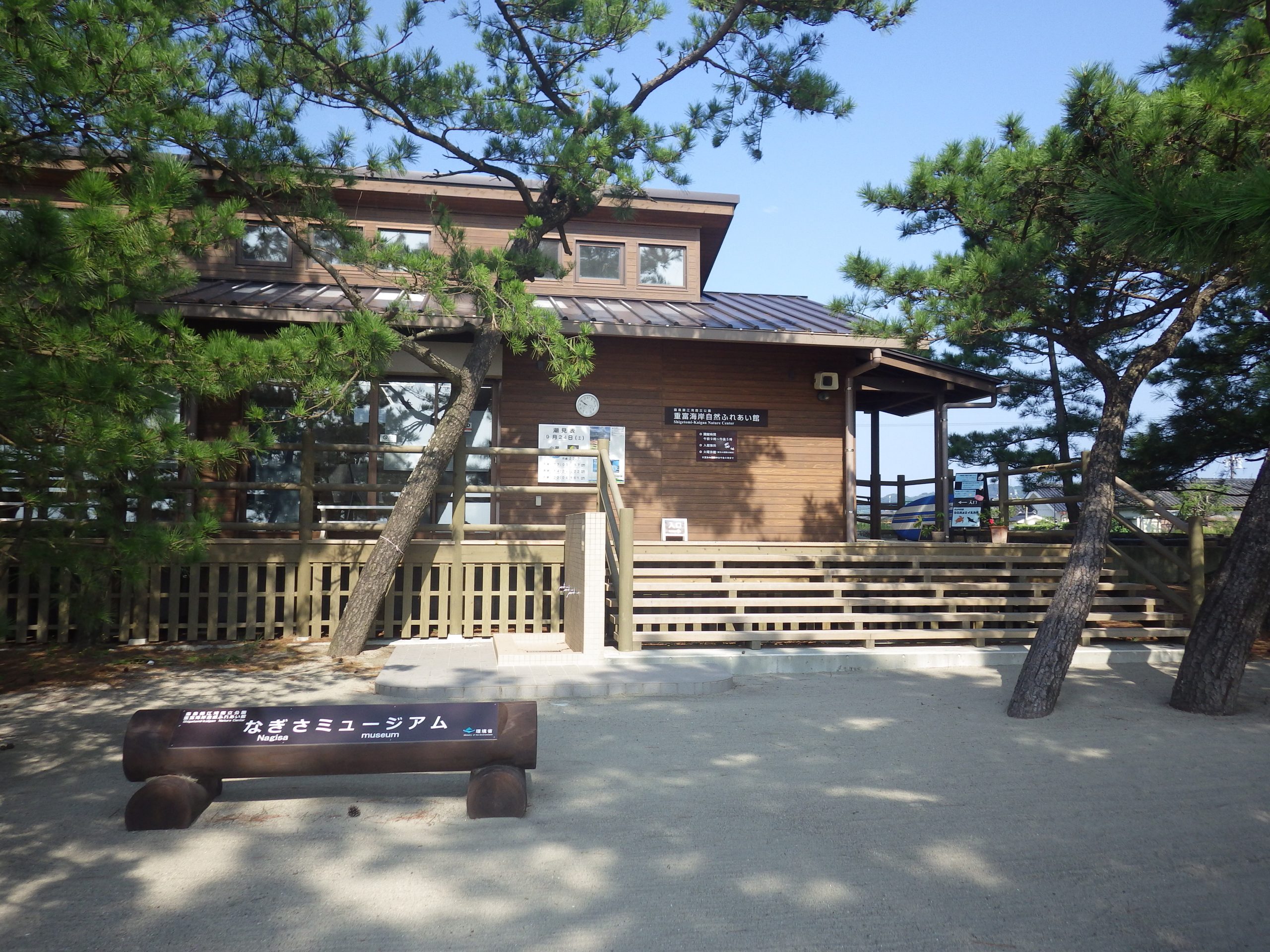
Nagisa Museum
Operated by NPO Kusunoki Native world that carries out environmental conservation efforts on Shigetomi beach. Here, you can learn about many creatures in Kinko Bay, through tideland observations and other activities.
- Information
-
-
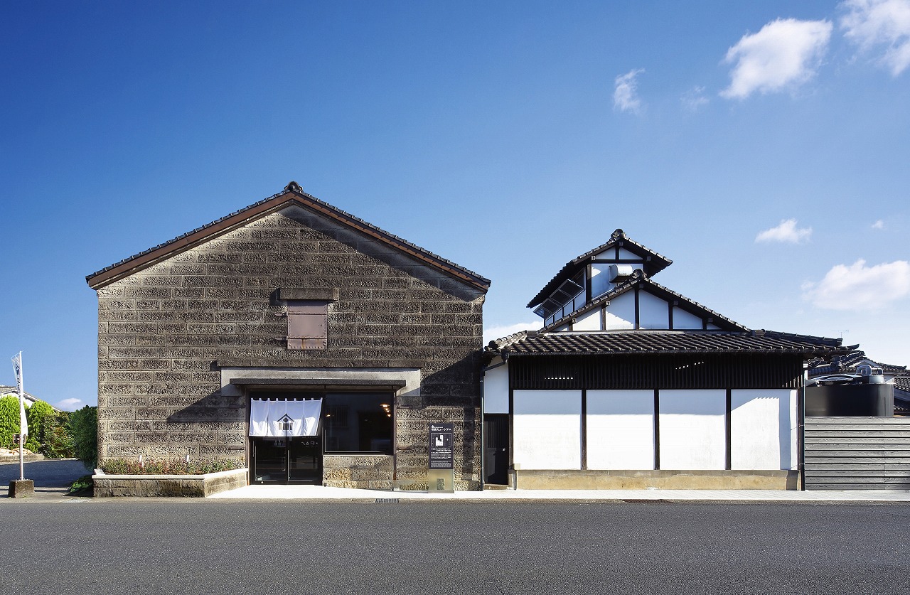
Ishigura Museum
Shirakane shuzou, a shochu company, was founded in 1869. Shochu is made according to tradition in this stone warehouse made from Kajiki stone. In addition, factory tours are available for you to learn the history of sweet potato shochu, and the facility includes a shop. Registered as a National Tangible Cultural Property.
- Information
-
- 40 min. from Kagoshima-chuo station by car
- Parking: 23 vehicles
- Closed: Wednesdays, summer vacation, year-end and New Year holidays
Tarumizu City
-
-
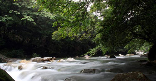
Sarugajo Valley
Located at the foot of Mt. Takakuma and designated as both a prefectural national park and Osumi recreation forest. This is one of the best spots to relax, which cool, clear water flowing through lush greenery and beautiful valley formed by large, uniquely shaped white granite(rocks).
- Information
-
- 40 min. from Kagoshima port by car
- Parking: 60 vehicles
-
-
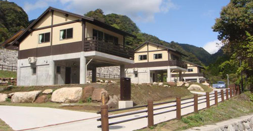
Sarugajo Valley Forest Station Tarumizu
The base facility for Sarugajo Valley, located at the foot of the Takakuma Mountains. Provides hands-on experiences, such as exploring the valley and climbing mountains. In addition, a lodging facility (cottage) suited to all seasons is available. Here you can enjoy hands-on tourism through interacting with nature.
- Information
-
- 40 min. from Kagoshima port by car
- Parking: 24 vehicles
-

-
Tontoko net fishing
A type of net fishing that involves dragging the net along the bottom of the ocean to catch varieties of shrimp living in the deep sea, such as “Namikudahige-ebi” and “Himeama-ebi.” Namikudahige-ebi are a valuable variety of shrimp, being tender and sweet but only able to be eaten in this region due to spoiling easily.
The deepest part of the Kinko Bay serves as the main fishing area. This traditional type of fishery consists of extending a long rope of around 2000 meters behind the boat and dropping a net to the bottom of the ocean; skillful rope-handling is then needed to wind up the net to capture the shrimp.
-

-
Amberjack cultivation
Cultivation of greater amberjacks and Japanese amberjacks thrives in Kinko Bay, taking advantage of the unique tranquility of the inlet with a maximum depth of over 200 meters.
The greater amberjacks cultivated in Kinko Bay, the area in Japan with the largest production of cultivated greater amberjacks, are well-received across Japan for their taste and quality, and are popular as a delicacy in the Kanto Region.
-
-
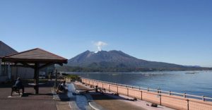
Roadside Station Tarumizu Yuttarikan
Located on the route from Kirishima to Sakurajima and Cape Sata to Kagoshima City, at the entrance to the Osumi Peninsula.
This roadside station serves as a hands-on tourism experience to promote exchange with neighboring urban areas, with natural radon hot springs and footbaths and provision of greater amberjack fresh from Kinko Bay.
This station ranked in 4th place in a “Tripadvisor Top Roadside Stations to Visit Ranking” published in 2017, for its spectacular views of Sakurajima, Kinko Bay and the Kirishima Mountains and as a place of rejuvenation.